# Walkers, a map widget for Rust

[](https://crates.io/crates/walkers)
[](https://docs.rs/walkers/latest/)
Walkers is a slippy maps widget for [egui](https://github.com/emilk/egui),
similar to very popular [Leaflet](https://leafletjs.com/), but written in Rust.
It compiles to native applications as well as WASM. See the **[online demo here](https://podusowski.github.io/walkers/)**.
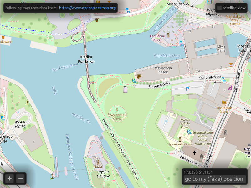
It supports [OpenStreetMap](https://www.openstreetmap.org), [mapbox](https://www.mapbox.com/),
and compatible tile servers as well as off-line tiles using the [PMTiles](https://protomaps.com/pmtiles/) format.
Before deploying your application, please get yourself familiar with the
[OpenStreetMap usage policy](https://operations.osmfoundation.org/policies/tiles/),
and consider donating to the [OpenStreetMap Foundation](https://supporting.openstreetmap.org/).
## Features
- Fetching tiles over HTTP from XYZ tile servers.
- Reading tiles from local `.pmtiles` files.
- Raster tiles rendering.
- Vector tiles (MVT) rendering with styling similar to [MapLibre style](https://maplibre.org/maplibre-style-spec/).
- Experimental local `.geojson` files support.
## Quick start
Walkers has three main objects. `Tiles` downloads images from a tile map provider
such as OpenStreetMap and stores them in a cache, `MapMemory` keeps track of
the widget's state and `Map` is the widget itself.
```rust
use walkers::{HttpTiles, Map, MapMemory, Position, sources::OpenStreetMap, lon_lat};
use egui::{Context, CentralPanel};
use eframe::{App, Frame};
struct MyApp {
tiles: HttpTiles,
map_memory: MapMemory,
}
impl MyApp {
fn new(egui_ctx: Context) -> Self {
Self {
tiles: HttpTiles::new(OpenStreetMap, egui_ctx),
map_memory: MapMemory::default(),
}
}
}
impl App for MyApp {
fn ui(&mut self, ui: &mut egui::Ui, _frame: &mut Frame) {
ui.add(Map::new(
Some(&mut self.tiles),
&mut self.map_memory,
lon_lat(17.03664, 51.09916)
));
}
}
```
You can see a more complete example [here](https://github.com/podusowski/walkers/blob/main/demo/src/lib.rs).
## Running the demo
### Native
To run demo application locally, use a default cargo run target.
```sh
cargo run
```
### Web / WASM
```sh
cd demo_web
trunk serve --release
```
### Android
You need to have [Android SDK](https://developer.android.com/) and
[cargo-ndk](https://github.com/bbqsrc/cargo-ndk) installed.
```sh
cd demo_android
make run-on-device
```
## Offline maps
To obtain offline maps in `.pmtiles` format, you can fetch Dolnośląskie region extract from
[Protomaps](https://docs.protomaps.com/guide/getting-started) using:
```sh
just protomaps-dolnoslaskie
```
You can also use [Overpass API](https://overpass-api.de/) to fetch hiking trails in GeoJSON format:
```sh
just overpass-trails-dolnoslaskie
```
## Mapbox support
To enable **mapbox** layers, you need to define `MAPBOX_ACCESS_TOKEN` environment
variable before building. You can get one by creating a
[mapbox account](https://account.mapbox.com/).